

Maps and Formation Information for Fairfax through Frederick Counties
 Fairfax
County was named for Thomas Fairfax, sixth baron Fairfax of Cameron,
proprietor of the Northern Neck. It was formed from Prince William
County in 1742. Its area is 410 square miles, and the county seat is
Fairfax. [Back].
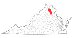
Fairfax
County was named for Thomas Fairfax, sixth baron Fairfax of Cameron,
proprietor of the Northern Neck. It was formed from Prince William
County in 1742. Its area is 410 square miles, and the county seat is
Fairfax. [Back].
 Fauquier
County was named for Francis Fauquier, lieutenant governor of
Virginia from 1758 to 1768. It was formed from Prince
William County in 1759, and its area is 651 square miles.
The county seat is Warrenton. [Back]
Fauquier
County was named for Francis Fauquier, lieutenant governor of
Virginia from 1758 to 1768. It was formed from Prince
William County in 1759, and its area is 651 square miles.
The county seat is Warrenton. [Back]
 Fincastle
County (extinct) was named either for George, Lord Fincastle,
Lord Dunmore's son; for John Murray, fourth earl of Dunmore,
Viscount Fincastle; or for the town of Fincastle, Virginia, which
was established in 1772 and named after Lord Botetourt's home in
England. The county was created from Botetourt County in
1772. It became extinct in 1776 when it was divided to form
Montgomery, Washington, and Kentucky (now the state of Kentucky)
Counties. See Kentucky, Montgomery, and Washington
Counties. [Back]
Fincastle
County (extinct) was named either for George, Lord Fincastle,
Lord Dunmore's son; for John Murray, fourth earl of Dunmore,
Viscount Fincastle; or for the town of Fincastle, Virginia, which
was established in 1772 and named after Lord Botetourt's home in
England. The county was created from Botetourt County in
1772. It became extinct in 1776 when it was divided to form
Montgomery, Washington, and Kentucky (now the state of Kentucky)
Counties. See Kentucky, Montgomery, and Washington
Counties. [Back]
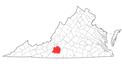
 Floyd County was named
for John Floyd, governor of Virginia from 1830 to 1834.
It was formed from Montgomery County in 1831, and part of
Franklin County was added in 1873. Its area is 383 square
miles, and the county seat is Floyd. [Back]
Floyd County was named
for John Floyd, governor of Virginia from 1830 to 1834.
It was formed from Montgomery County in 1831, and part of
Franklin County was added in 1873. Its area is 383 square
miles, and the county seat is Floyd. [Back]
 Fluvanna
County was named after the eighteenth-century term for the upper
James River. The name, meaning river of Anne, was given in
honor of Queen Anne of England. The county was formed from
Albemarle County in 1777. Its area is 282 square miles, and
the county seat is Palmyra. [Back]
Fluvanna
County was named after the eighteenth-century term for the upper
James River. The name, meaning river of Anne, was given in
honor of Queen Anne of England. The county was formed from
Albemarle County in 1777. Its area is 282 square miles, and
the county seat is Palmyra. [Back]
 Franklin County was named for Benjamin
Franklin and was formed from Bedford and Henry Counties in 1785. Its
area is 711.5 square miles, and the county seat is Rocky Mount.
[Back]
Franklin County was named for Benjamin
Franklin and was formed from Bedford and Henry Counties in 1785. Its
area is 711.5 square miles, and the county seat is Rocky Mount.
[Back]
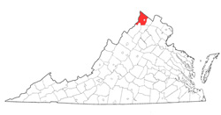 Frederick County was named for Frederick
Louis, Prince of Wales and eldest son of George II. It was formed
from Orange County in 1738, but the county government was not organized
until 1743. Part of Augusta County was added later. Its area
is 426 square miles, and the county seat is Winchester. [Back]
Frederick County was named for Frederick
Louis, Prince of Wales and eldest son of George II. It was formed
from Orange County in 1738, but the county government was not organized
until 1743. Part of Augusta County was added later. Its area
is 426 square miles, and the county seat is Winchester. [Back]
