

Maps and Formation Information for Giles through Greensville Counties
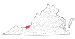 Giles
County was named for William Branch Giles, United States senator from
Virginia, in 1806. It was formed from Montgomery, Monroe (West
Virginia), and Tazewell Counties. Part of Wythe County was added in
1808, parts of Tazewell County were added in 1826 and 1836, part of Monroe
County was added in 1829, parts of Mercer (West Virginia) County were added
in 1840-1841, and part of Craig County was added in 1858.
Its area is 363 square miles, and the county seat is Pearisburg. [Back]
Giles
County was named for William Branch Giles, United States senator from
Virginia, in 1806. It was formed from Montgomery, Monroe (West
Virginia), and Tazewell Counties. Part of Wythe County was added in
1808, parts of Tazewell County were added in 1826 and 1836, part of Monroe
County was added in 1829, parts of Mercer (West Virginia) County were added
in 1840-1841, and part of Craig County was added in 1858.
Its area is 363 square miles, and the county seat is Pearisburg. [Back]
 Gloucester
County was probably named for the English county, although it may
have been meant to honor Henry, duke of Gloucester, the third son
of Charles I. It was formed from York County in 1651.
Its area is 225 square miles, and the county seat is Gloucester.
[Back]
Gloucester
County was probably named for the English county, although it may
have been meant to honor Henry, duke of Gloucester, the third son
of Charles I. It was formed from York County in 1651.
Its area is 225 square miles, and the county seat is Gloucester.
[Back]
 Goochland
County was named for Sir William Gooch, lieutenant governor of
Virginia from 1727 to 1749. It was formed from Henrico
County in 1728. Its area is 289 square miles, and the
county seat is Goochland. [Back]
Goochland
County was named for Sir William Gooch, lieutenant governor of
Virginia from 1727 to 1749. It was formed from Henrico
County in 1728. Its area is 289 square miles, and the
county seat is Goochland. [Back]
 Grayson County was named
for William Grayson, a delegate to the Continental Congress from
1784 to 1787 and one of the first two United States senators from
Virginia. It was formed from Wythe County in 1792, and a
part of Patrick County was added in 1810. Its area is 454
square miles, and the county seat is Independence. [Back]
Grayson County was named
for William Grayson, a delegate to the Continental Congress from
1784 to 1787 and one of the first two United States senators from
Virginia. It was formed from Wythe County in 1792, and a
part of Patrick County was added in 1810. Its area is 454
square miles, and the county seat is Independence. [Back]
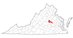
 Greene
County was named for Nathanael Greene, American commander of the
Army of the South in the Revolutionary War. It was formed
from Orange County in 1838. Its area is 153 square miles,
and the county seat is Stanardsville. [Back]
Greene
County was named for Nathanael Greene, American commander of the
Army of the South in the Revolutionary War. It was formed
from Orange County in 1838. Its area is 153 square miles,
and the county seat is Stanardsville. [Back]
 Greensville County was named for either
Revolutionary War general Nathanael Greene or for Sir Richard Grenville,
leader of the Roanoke Island settlement of 1585. The county was
formed from Brunswick County in 1781. Part of Brunswick County was
added in 1787 and part of Sussex County was added in 1802. Its area
is 300 square miles, and the county seat is Emporia. [Back]
Greensville County was named for either
Revolutionary War general Nathanael Greene or for Sir Richard Grenville,
leader of the Roanoke Island settlement of 1585. The county was
formed from Brunswick County in 1781. Part of Brunswick County was
added in 1787 and part of Sussex County was added in 1802. Its area
is 300 square miles, and the county seat is Emporia. [Back]
